Tram in Hannover, Germany
06.06.2026 - page under construction!
Intoduction
I would like to document the changes to the Hanover tram network here. I will depict the route`s development over time on a map and link to as many photos as possible from different eras. Initially, I want to focus on the period before and during the construction of the subway. Every photo is welcome – regardless of quality. However, the images must either be free of all rights, or you must be the copyright holder who grants me permission to publish them here on my site.
Objectives of the interactive route map project
- Identifying the route within the current cityscape
- Visualizing the historical development of the tram network
- Supplementing the reading of relevant books
Technical implementation
For capturing time-dependent geodata, I familiarized myself with the open-source program QGIS (qgis.org) during the Osnabrück tram project. This allows for the georeferenced drawing of any element and the assignment of a time period to it. The freely available OpenStreetMap (openstreetmap.org) served as my "drawing background." This is a global map resource created and maintained by volunteers. For Hanover, I also have a 1:1000 scale map from the 1930s, which depicts the tram system very accurately (source: opengeodata-hannover.de, CC BY 4.0 DE). I am still searching for old route maps from other eras – today, in 2026, I am still at the very beginning of this project, which will certainly keep me busy for a few years. Unlike the Osnabrück project, I will host all map data and software for Hanover myself to ensure the project`s longevity and, if necessary, to allow offline use.
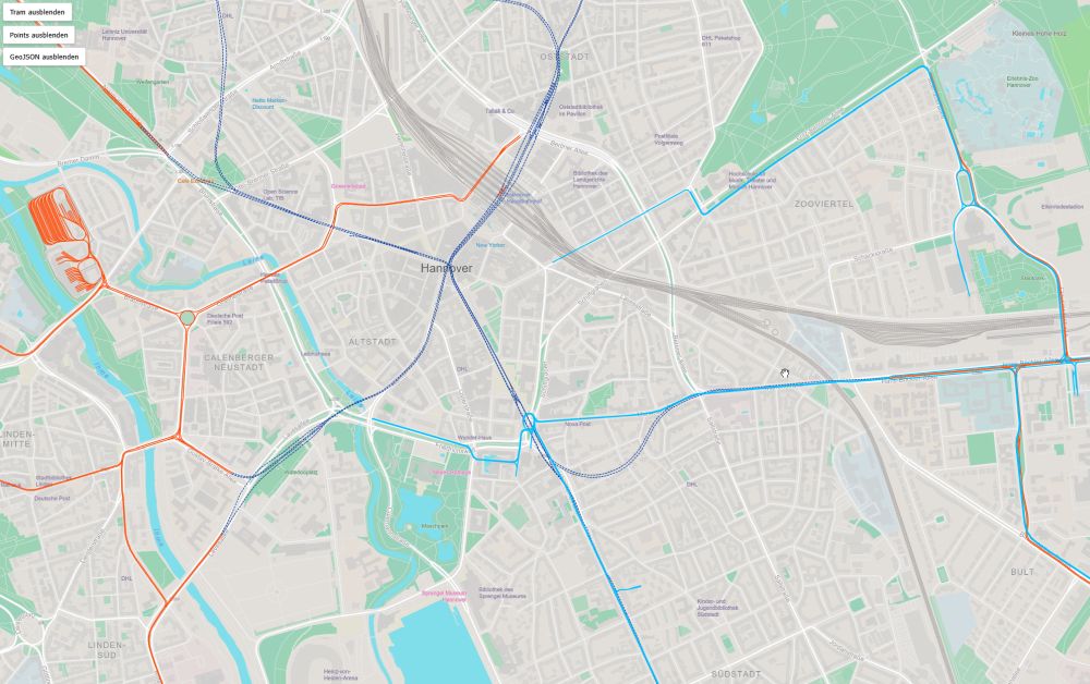
Bildschirmfoto der Weboberfläche zur Navigation im Streckenplan der Straßenbahn Hannover
The map is not yet complete and is therefore not yet publicly accessible. If you are interested in test access, please feel free to contact me!
Operating the map
As of May 2026, there is still only a simple concept for operating the map and controlling information, as everything is still under development!
Information accuracy
Page under construction!
Page under construction!